University of Jyväskylä | JYX Digital Repository

  • English  | Give feedback |
    • suomi
    • English
 
  • Login
JavaScript is disabled for your browser. Some features of this site may not work without it.
View Item 
  • JYX
  • Historialliset kartat
  • www.vanhakartta.fi -portaalin karttatiedostot
  • Yleiskartat
  • Wetterstedtin maakuntakartasto 1775
  • View Item
JYX > Historialliset kartat > www.vanhakartta.fi -portaalin karttatiedostot > Yleiskartat > Wetterstedtin maakuntakartasto 1775 > View Item

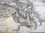
Karjala

Thumbnail
View/Open
12. Mb

Downloads:  
Show download detailsHide download details  
Authors
Wetterstedt, Eric
Date
1775

 
Spatial coverage
Viipurin lääni   Kymen lääni
Keywords
tiet Venäjä Ryssland
URI

http://urn.fi/URN:NBN:fi:jyu-201007272372

Metadata
Show full item record
Collections
  • Wetterstedtin maakuntakartasto 1775 [22]

Related items

Showing items with similar title or keywords.

  • Itämeren ympäristö 

    Biurman, Georg (1747)
  • Pohjoismaat 

    Bureus, Andreas (1626)
  • Savo 

    Wetterstedt, Eric (1775)
  • Svecia et Norvegia 

    Unknown author (1595)
  • Uusimaa 

    Wetterstedt, Eric (1775)
  • Browse materials
  • Browse materials
  • Articles
  • Conferences and seminars
  • Electronic books
  • Historical maps
  • Journals
  • Tunes and musical notes
  • Photographs
  • Presentations and posters
  • Publication series
  • Research reports
  • Research data
  • Study materials
  • Theses

Browse

All of JYXCollection listBy Issue DateAuthorsSubjectsPublished inDepartmentDiscipline

My Account

Login

Statistics

View Usage Statistics
  • How to publish in JYX?
  • Self-archiving
  • Publish Your Thesis Online
  • Publishing Your Dissertation
  • Publication services

Open Science at the JYU
 
Data Protection Description

Accessibility Statement

Unless otherwise specified, publicly available JYX metadata (excluding abstracts) may be freely reused under the CC0 waiver.
Open Science Centre